PROJECTS
Client: Ventura Land Trust
Project: Arroyo Simi Habitat Restoration and Enhancement Project Phase II - Urban Rivers
Location: Simi Valley, California
Description: Wildscape is performing habitat restoration across 40-acres as a part of the Arroyo Simi Habitat Restoration and Enhancement Project, Phase II. This project is funded by Proposition 1 funding! Wildscape is removing invasive species with a focus on arundo (Arundo donax). Wildscape's crew perform arundo removal through various methods, including hand removal with herbicide application (also known as the cut-and-daub method), foliar herbicide application, and mechanical removal. The mechanical removal involved driving a skid steer with a forestry mulching head attachment to knock down the arundo and mulch it over. Any arundo near native vegetation, such as willows, is removed carefully by hand. Wildscape biologists perform construction monitoring, nesting bird surveys, and annual surveys with detailed reports.
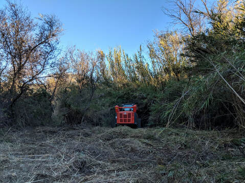
Before
|
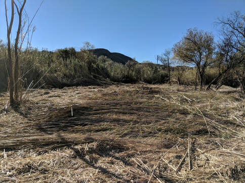
After
|
Client: Williams Homes
Project: Phantom Trail Residential Development
Location: Santa Clarita, California
Description: Wildscape has worked on multiple phases of the Phantom Trail Development Project in Santa Clarita. The project included the development of 29 homes with 68 acres of open space. Wildscape has surveyed for special status species including the slender Mariposa lily (Calochortus clavatus var. gracilis) and Peirson's morning glory (Calystegia peirsonii). Wildscape has conducted habitat mitigation maintenance and monitoring in compliance with CEQA mitigation and regulatory permits. Wildscape performed construction monitoring during pioneering earthwork in previously undistrubed areas to minimize impacts to environmental resources during construction of the homes.
The habitat mitigation maintenance for this project site includes the removal of non-native invasive woody plant species and revegetation of special status plant species. Wildscape monitors the site annually to ensure the mitigation criteria is being met.
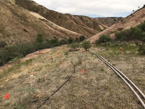
Phantom Trail with irrigation for revegetation
|
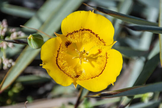
Slender Mariposa lily
|
Client: City of Santa Clarita
Project: Santa Clarita River Site Specific Implementation Project
Location: Santa Clarita, California
Description: Wildscape has worked with the City of Santa Clarita over various years since 2007 removing arundo the Santa Clara River as a part of the Arundo Removal Site Specific Implementation Project. The City of Santa Clarita and the Ventura County Resource Conservation District (VCRCD) partnered in 2004 to start the arundo removal efforts and over the last 16 years the City has been continuing the Project. The Project is 297 acres located in the Santa Clara River.
Wildscape has performed project management, biological monitoring, and arundo removal and treatment. Wildscape has provided contractor education for crews including identification of native plants and non-native target species and Best Management Practices. Wildscape has worked with the VCRCD and regulatory agencies for permitting and compliance. Wildscape has also preformed arundo removal through hand removal and chemical treatments.
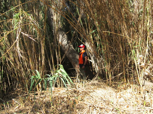
Before arundo removal
|
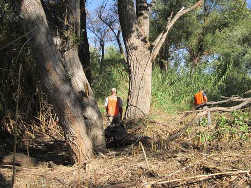
After arundo removal
|
Client: Vandenberg Air Force Base
Project: Vandenberg Air Force Base Vegetation Mapping
Location: Vandenberg, California
Description: Wildscape updated vegetation maps for Vandenberg Air Force Base (VAFB). Wildscape analyzed and interpreted digital high-resolution aerial photography and existing general vegetation data utilizing a modified Sawyer Keeler-Wolf classification system to determine boundaries and distribution of vegetation types, including average density and height. The mapping effort encompassed the full 99,000-acre extent of VAFB with a minimum mapping unit of 5 acres. Vegetation was classified using a modified Holland system and resulted in the creating of 3,555 polygons; including the establishment of 43 vegetation types that were listed in details in a report prepared by Wildscape for the VAFB.
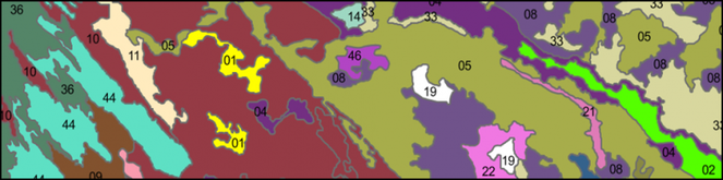
Vegetation Map for Vandenberg Air Force Base